Saariselkä – 3,752km completed
At least I didn’t have to do the long trudge back to reception on foot – with bike loaded up, I could pedal around to drop off the key and grab my packed breakfast. It was another clear blue morning, still a hint of chill in the air but nowhere near as cold as yesterday. I was planning to grab a coffee if possible and eat some of the food, so it would hopefully be warmer still in the 30 minutes it took to do that.
It was early, so the guy at reception was night staff. But he showed no reluctance at my request for coffee and after handing me my parcel, he immediately set about firing up the filter machine. He even brought my cup over to where I sat on one of couches by the window, scoffing down most of the contents of the bag. It was a lot though so, as had become routine, what I didn’t have the capacity to eat there and then got crammed into pockets and bags for later on. Each of my daily routines were on auto pilot by now – how does the saying go, it takes 20 days to form a new habit. I think these had become habitual a week or more back, so maybe that timeline gets compressed when the routine is absolute – all of every day follows the same pattern.
Riding back through the resort I was struck again by the scale of the place – an entire street of shops had been built as well as the hotel, cabins, ski lifts etc. All deserted of course at this early hour, just me rolling quietly along taking in the sights. Back at the main road I did not get far before having to pull over again. Wheeling up to cruising speed I realised my estimation of “chilly” had been generous – it was actually flipping cold once you were moving through it. There were points on the early section where the Garmin shows it as low as 3C, and my bones were definitely feeling that. The addition of leggings and base layer under my jacket plus gloves and warm beanie was enough to take away most of that, apart from some sharp stabbing in the very tips of my fingers. Leaving Italy in close on 40C heat it had seemed mad to be lugging all this cold weather gear – but now, it was barely enough.
At the risk of stating the obvious, you don’t build ski resorts where it’s flat. And for some distance ahead, the terrain bore this out. Much of the climbing was already done to get here yesterday, but there was still a high windswept ridge to be climbed, with what I assumed were avalanche barriers stretched along its side. Even on a milder day like today, an icy wind whipped across the top of that ridge, swirling around a distant cluster of buildings – maybe a piste side café or refuge in the winter. Once crested, the drop down the other side was dramatic – from 365m down to 120m, most of which descended in a single swooping curve from the top. Over the ridge I was mostly sheltered from the wind, although I vaguely recall an occasional wobble from side gusts. With the added speed the cold bit into me fiercely – my hands rapidly becoming ice blocks as I sped down. Fortunately, as the gradient levelled out in the valley below the temperature picked up and warmth slowly reached my extremities, helped by the rolling terrain which delivered some extra warmth from the effort.
I’d contemplated a coffee stop in the “city” of Ivalo. I mark that in quotes there because it was described as such in the event guide, and this far north it was bigger than anything around – but it was still a small town by more usual standards. It did have plenty of shops and cafes, but none were open yet, and I’d only been on the road just over an hour anyway, so it was too early to be thinking about a stop. Instead I rolled through at an easy pace. As I did so, I was struck by how much it looked and felt like a frontier town. The buildings, cars etc. were too modern to say it looked like a wild west town, but there was something about the aura of the place which created that vibe. It wasn’t the last town northwards, or even the last town in Finland, but if you’d stopped me there and told me it was I’d have believed you. And then, at the top of town, I saw a sight so odd it completely floored me. As I was about to turn left at a roundabout and leave the town I noticed that the right turn off the roundabout was signposted RUS.
WTF! Russia?
I’d ridden so far north, I had just passed a road sign to Russia. It strikes me now, writing this, that maybe that proximity was what created the border town feel I’d had riding through Ivalo.
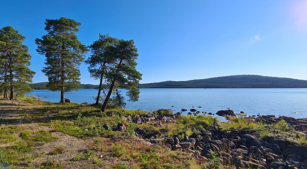
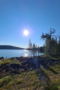
It was a slow haul up and away from the town, during which every other truck and van seemed to have slogans for some Telco or other. There were a few cars, but mostly apart from work vehicles it was camper vans. The traffic was light overall, but what there was seemed to be here either for work or touring. And heck, I soon saw why. The landscape beyond became just jaw dropping – I just do not have words to fully portray it. The nearly 4,000km behind me, would have been worth it just for this bit. I’ve ridden through Scotland, and the Lake District, and been wowed by them. But this was like both of them combined and then squared. And there was water everywhere. Alongside the road crystal clear rivulets ran between larger pools and ponds in the forest – the water in them so pure it was like an optical illusion. When you looked straight down into them, the pebbles at the bottom were visible so sharply it was impossible to tell you were actually looking through water at all. Never in life have I seen water so unpolluted. Looking at the nature all around, I realised that this was what all water looked like before we came along and started throwing our crap into it. Seeing all this was both joyful and sad in equal measure.
I pulled in for a quick pitstop at a layby beside one of the larger lakes – only a pee of course, but even that felt bad surrounded by such pristine beauty. I made sure I was well away from the lake waters, and out of sight of the campervans in the parking lot before watering one of the many pine trees. Back at the bike, I fished a banana and a snack out of the bag and ate them whilst taking in the view. A curtain twitched in the nearby camper, and then having checked I wasn’t nicking bikes off their rack, retired back to bed. The riding beyond this brief loo/food/view stop (never do just 1 thing remember) was lumpy, but never horrendously so – short ramps of 50 to 70m, and well worth it for the view. At regular intervals along the road there were signs warning about a salmon virus of some kind and how to prevent it. I was also struck by the hillsides and woodland too – which although superficially just more pine trees along lakes, was very different to that in Sweden when you looked closely. The soil under the trees was harsher – that sort of dry, sandy, gravel you find far south in places like Greece. As a result, there was none of the lush green undergrowth of bushes which the woods in Sweden had. This was a different kind of beauty, rocky and more sparse. The where a few deciduous trees mixed in with the pines – mostly birch. The autumn yellow of their leaves adding bright patches of colour against the swathe of deep greens and browns. If my ride had ended right there, along this road, I’d have found it very hard to leave – the beauty was overwhelming.
This gorgeous section came to an end with something predictable – a city, in this case Inari. Insert your own quotes around city if you like, it was about as small as Ivalo. I pulled over at a K-Market in the middle of the town and ducked in for supplies. As well as the usual, I also needed fresh batteries for my rear blinkies, and specifically hunted out more of the mini pizzas and pies at the bakery section. I seem to recall getting extra sun cream too – but maybe I just put on more of what I had with me. It was now warm and sunny, and I ditched all my layers whilst I sat at one of the tables outside eating. There were café options in town, but my supermarket routine was now honed for time efficiency, and seemed to be delivering plenty of calories so I stuck with what was working. I looked out over the large expanse of lake beyond the road. It was easy to imagine it was the coastline, in fact I do seem to recall wondering if it was the sea. I guess in a sense it is. Looking at the map, this was part of a vast area of lakes that effectively could have been an inland sea.
The lakeside town sat at about 120m. Over the next few hours – to get across to Norway, the route would rise up to about 330m, almost the height of the first peak leaving Sariselka. But although the general trajectory was upwards, the altitude was gained in the most punishing way possible. A series of short steep ramps up, followed by descents which lost almost but not quite all of the height gained. On paper, the overall elevation of this day doesn’t look much, but in practice, on a sunny day now around 26C, it was a hard, painful slog. Yes, the scenery was still lovely, but I swore at every crinkle in the road. Worse still as I crept ever further North all I could see ahead was endless rolling hills. It was clear that the rest of the day would be more of the same.
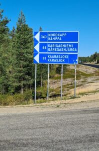
For 30km after Inari the route followed a narrow strip of road and woodland, threaded between and around lakes. At the 104km mark for the day though, the route turned left off the E75 which we had been following since Rovaniemi and onto a more minor road. That junction will live long in my memory for a couple of reasons. Firstly because the turn was actually signposted to the North Cape (there had been distance markers earlier I think, but this was an actual direction sign). The second reason was the landscape – which shifted dramatically. The road immediately felt different – it was like riding across a series of sand dunes with low woodlands on them. The land around and in between was flatter, less rocky, and the water lay in green marshy pools of the lower sections rather than deep lakes carved into rocky ravines. Norway was still some distance ahead, but we had visibly started out across a different land at this point.
The rollers were hot, endless, and crippling. My legs had felt no fatigue for days, but the short steep pitches across each dune made my calves and glutes burn. A few of them pitched into double digit gradients that had me standing even in crawler gears. I battled on for about an hour after the turn before I started scanning for somewhere to take a break. This was properly remote terrain, with nothing for miles, so there was no point just wishing for a café. I pulled over to scan my cue cards for a proper plan. Sure enough, I’d marked a campsite just ahead as a possible stop for food and drink. There were other options, but they were signposted off route up long gravel tracks, whereas this was right beside the road. I slogged up and over one last big roller and there it was just as my cue cards had promised – a sign left saying “Muotkan Ruoktu“, with knife and fork symbols.
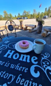
The café was open, and the staff friendly. I grabbed coffee and doughnuts, checked before eating my own sandwich, and sat outside in the shade enjoying the vast, remote view. I chatted at length with another chap sat outside – a friend of the owners as it turned out, and a frequent visitor in both summer and winter. On this occasion he and his family were here as part of a summer tour, but last winter they had come up to do some ski touring with the owners (who were both local guides). I was a little surprised to learn the owners stayed here all year around. I’d assumed the weather would be just too harsh in mid-winter. But the lady owner explained it was a dry cold, which she found more enjoyable than winters in her native Poland. Put like that it made sense – I could only imagine how beautiful it would look in winter and made a mental note to come back some day and see it for myself. With the excellent coffee and company it became a much longer stop than I had intended, and it was a wrench to get back on the road. I was helped out of my chair by assurances from the initial chap I’d spoken too and the owners. They both commented that it got easier not much further along – the worst of the rollers were almost done.
It was still almost a couple of hours of riding to get up and across the higher ground. As I rode up, the trees shrunk in size, and vast expansive of grassy moorlands opened out, with views that spread ever further across to distant hills, far away into Norway. It wasn’t really clear how many of these I would have to get over, but somewhere inside I knew the way ahead couldn’t possibly be along flat valleys and coastline. It’s interesting how if someone tells you something will be easier, your mind finds it so. Looking at the stats now, the climbing after the campsite break was actually more than that before. A couple of digits less in gradient, but significantly higher and longer. But with the assurances of easier riding, and my general enjoyment of the day now I had caffeine and cakes on board, my gaze was no longer downwards, swearing into the tarmac. My head was up and I was loving the riding, the views, and yet more ridiculously clear streams which the road crossed over frequently. On the righhand side, the terrain alternated between patches of marshland and high grassy plain. To the left was a small river valley with low, stunted trees which the road followed for a while. Out of nowhere, my wheels suddenly rolled free and I was racing down the descent to the border – a long drop which seemed to go on forever. I felt a twinge of sympathy for each of the heavily loaded tourers I past slogging up the other way. Although in truth, I’d already done more of the same myself – and I could see that over the river separating the two countries was another climb, so it wasn’t all downhill from here.
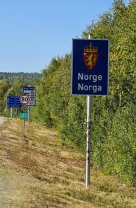
The border itself was much like every other in Europe – a handful of signs, and mostly a non-event. I was through the small town and out on the bridge across the river into Norway proper almost before I knew it. It would possibly have been an anti-climax except for a surprise on my Garmin. I’d regained the hour we lost riding into Finland. I messaged Christopher at some stage to say there was a gift waiting for him at the border. He only properly understood my message when he and Benjamin experienced what I was seeing now for themselves what I was seeing now. The extra time underlined a shift in plans I had made at some point earlier in the day. I’d originally booked a hotel in Karasjok, the first town into Norway and just up ahead. But although the distance was about right, it was way too early in the day. So I let this booking go and switched to Plan B which was a campsite cabin around 60km further. This a better use of the daylight and would make for a much better plan over the remaining days. A 200km leg would get me to a hotel at the foot of the final climbs and the last 30km of the event. I could stay there, enjoy a more leisurely breakfast, and leave in time to be at the visitor centre around 11am when the NorthCape4000 staff arrived to take photos and stamp cards. It was all perfect. A little too perfect as it would turn out.
After the river began another climb, not especially high or steep (never more than about 6%), but I could feel the strain on tired legs as I ground my way up. Once at the top, the hillside followed a valley, the river deep down below to the right. For some distance before the descent into town I could see the buildings of Karasjok lining the valley and spreading up a steep looking hillside beyond. Clearly that extra 60km wasn’t going to be flat – there was at least one more ridge to get over. I was a little worried about time – the campsite had been very strict on when reception closed, although based on where I messaged from the owner laughed at the thought I would not make it in time (she turned out to be right, I was being overly pessimistic). Nevertheless, I opted for another quick supermarket stop vs a café or restaurant. The campsite had a bar and promise of a pizza to top off my fuel for the day. And an offer of a packed breakfast for tomorrow, which cut down my need to carry much from the shop over the last stretch. I sat in the afternoon sun outside the shop eating a wrap and downing half a bottle of coke (the rest going in my pocket for the final stretch). I also grabbed an ice cream to top things off before bumping out through the parking lot and across a dug up section of road which led to the first ramp up and out of town.
The climb out of town was sizeable – 230m across 12km, with gradients up around 9%. Fuelled up though, it was just a steady grind to the top. I swapped places with a loaded touring bike at some point – I think I passed him, his rig being substantially heavier than mine. I also vaguely him passing me again once over the top of the climb when I pulled into the side of the road for a snack/pee/drink stop. The route sagged in the middle, across the high exposed ground, and then after a final short ramp a long descent into a deep valley below appeared up ahead. Based on the kilometres left to ride, I was sure this was the end of the climbing – one last drop down on fresh, fast, tarmac and the day was done. Early too, on account of the free hour. Although I nearly came to grief at the bottom of the descent. Flying along at top speed, the join with the old tar road looked OK so I didn’t slow down. Seeing it late, I only narrowly avoided an ugly pothole that would definitely have unseated me and probably trashed the rig at the speed I was going. I immediately stopped and sent a warning message to Christopher and Benjamin about this hazard – on the off chance they were still behind me, and yet to encounter it. The road surface from there became a little rough, with loose stones in places in addition to the random potholes. The campsite was further along the valley than I expected – prompting me eventually to mount up my phone with Google Maps to make sure I did not miss the turn.
Villa Skoganvarre was an unpretentious little campsite – mostly cabins, but some campervan space I think. An obvious low building marked reception, where I parked up, with toilet blocks and a shared kitchen in buildings beyond. The owner was friendly, checked me in, poured me a zero beer and said she’d get the oven on for my pizza whilst I dropped gear in the room. My cabin was a couple of hundred meters away along a rideable gravel road. The bike would have fitted inside, but it felt perfectly safe on the small porch so I left it outside. The pizza wasn’t ready when I got back, but came soon after along with another zero beer. It wasn’t the best peperoni pizza I’d had, but it was OK. Yoli swore though that this was the source of the troubles I was to experience later that night. I wasn’t so sure though. I had a strange feeling when filling my bottle from the kitchen drinking water tap, but stupidly did not act on it and use one of the purification tablets I was carrying for just such stops as these. We will never know I guess if this was the source of my impending doom, or whether it was something earlier in the day. But I’ll leave the full horror of the tale for the next episode, since it’d be a shame for it to pollute the awesome day just done.
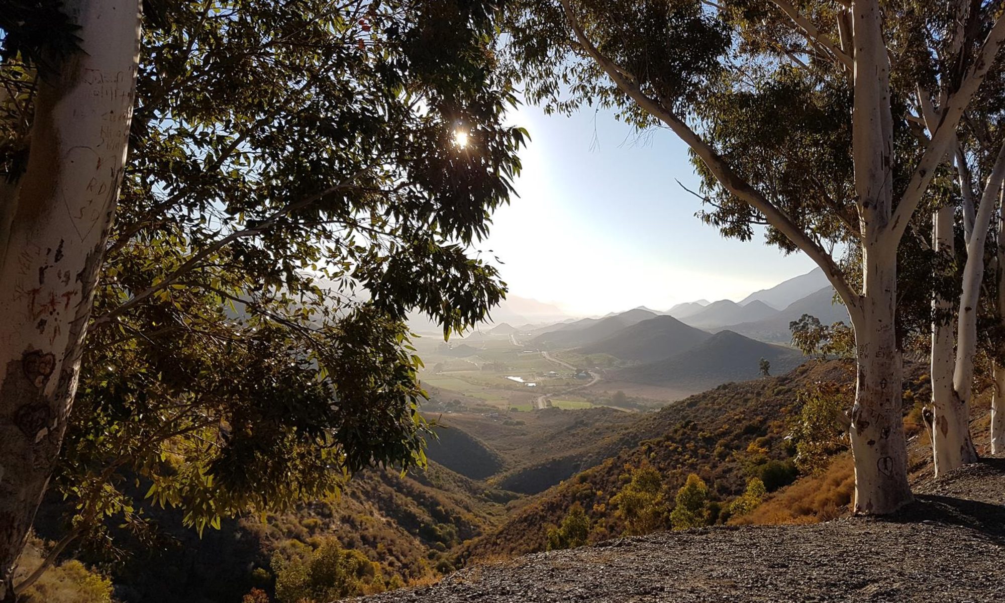
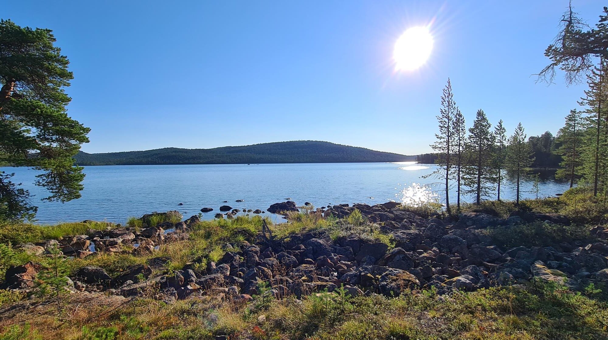
What a way to paint a picture: “through Scotland, and the Lake District…, but this was like both of them combined and then squared.” And seeing that Nordkapp sign must have been so rewarding.
It very much was – bizzare also to look at a distance over 300km and think “I’m nearly there”