
695km – 19 Aug, 06:36 – Fort William
At least one of my plans from the previous night was still roughly on track – I was up and out early in an attempt to beat the traffic. I had not, of course, been noisy in my exit, although carrying rather than wheeling my bike was mostly an attempt to slip past the night manager and avoid any awkward questions. He didn’t seem remotely bothered though, and wished me a good journey as I returned the key and stepped out into another damp, grey morning. And indeed, the roads were not that busy, but they were not that pleasant either. The few vehicles travelling south were mostly large trucks who seemed never to have heard of safe passing distances for cyclists. My second encounter with the A82 did at least confirm that I wanted no more time on it than absolutely necessary – a feeling that transferred itself through my cranks, picking up some pace as it did so. It was a good job too – as the expected 10km of busy road ended up being 20km – clearly my previous evening’s map studying had been somewhat awry.
Reaching the end of the bridge to South Ballachulish, the road made one last attempt to sway my course – in the form of a tempting blue Glencoe cyclepath sign, and a skinny lycra clad roadie eagerly hurrying his carbon steed toward the climb. It might have been enough to lure me, had it not been for a black and silver coach squeezing me into the gutter, in a hurry to get somewhere despite appearing completely empty. I paused before my turn to take stock – the A828 beneath me was also not devoid of traffic, nor any wider than the A82. But on the opposite side of the road was what looked like a cycle path heading off into the woods. It appeared a bit dingy and uninviting, and I hadn’t mapped it out as my alternate route. But I knew there was a continuation of the Caledonian Cycle Path down the peninsula toward Oban – and this was probably it. I wasn’t hopeful, but it was the safer option, and heading in the right direction, so I spun around, crossed the carriageway and rolled up the ramp to the path.
715km – 19 Aug, 07:43 – Caledonian Cycle Path part II
What came next was as delightful as it was unexpected. As if guarding the entrance to some magical kingdom, no sooner than I had passed through the ornate barriers at the start of the path than the morning and my mood were transformed. Ahead lay a stretch of fast, immaculate tar – squeezing between a line of trees, and ducking under old brick bridges, remnants its original role as a railway line. And above me, stretching along the length of the narrow path, a thin line of blue sky was breaking its way through the mists. A smile spontaneously spread across my face, turning into a full blow laugh at myself – why on earth had I been doubting a diversion onto back lanes and tracks. It was the whole reason I was here in the first place.


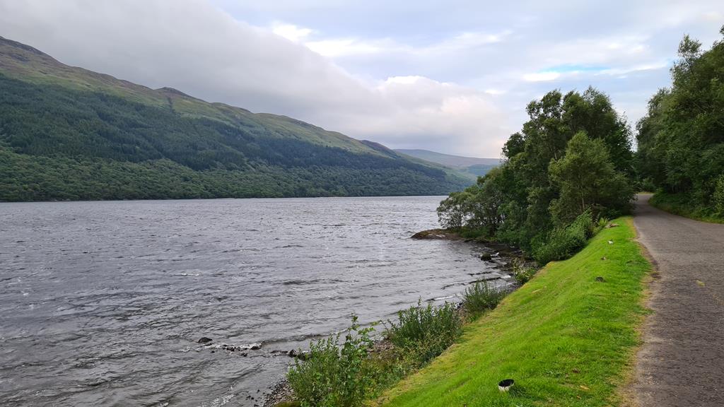
Improbable as it seemed, the route became even more stunning after a few kilometres – crossing the A road and running directly along the shore of the loch (or was it technically the sea, I’d kind of lost track of geography at this point). Whichever it was, one thing was certain – in its heyday this must have been one of the most scenic rail journeys in the whole of the UK, if not the world. I remember my father (an avid rail and steam enthusiast) had often talked fondly of Fort William. I wondered if perhaps this was the line which had inspired him. I’d been struck the evening before with the thought that maybe I was following paths by bicycle which perhaps he had ridden by train, and I had that sense again. In the bright but chilly morning, thin veils of mist swept across the water to my side. I was so lost in its beauty that I totally missed Tom’s joke in response to a photo I shared – he commented he saw no midges (Tom is American, and their term for midges is No-See-Ums).
It was an interesting and varied route – at a point a littler along, switching inland and rising up into a hidden valley away from the road. It was hard to be sure if this was still the route of the railway, but it was lovely regardless. It twisted along fields and wound through small clusters of houses. Very briefly it joined the main road before taking the most bizarre section of any cycle route I had encountered so far. The engineers seemed to have ambitions on creating their own mini Stelvio, the result being fresh, smooth tar laid in a perfect series of arcing switchbacks to climb no more than a handful of meters into the woodland beyond. Looking back as I took a photo, it was tempting to whiz back down it just for the fun of blasting around the curves.

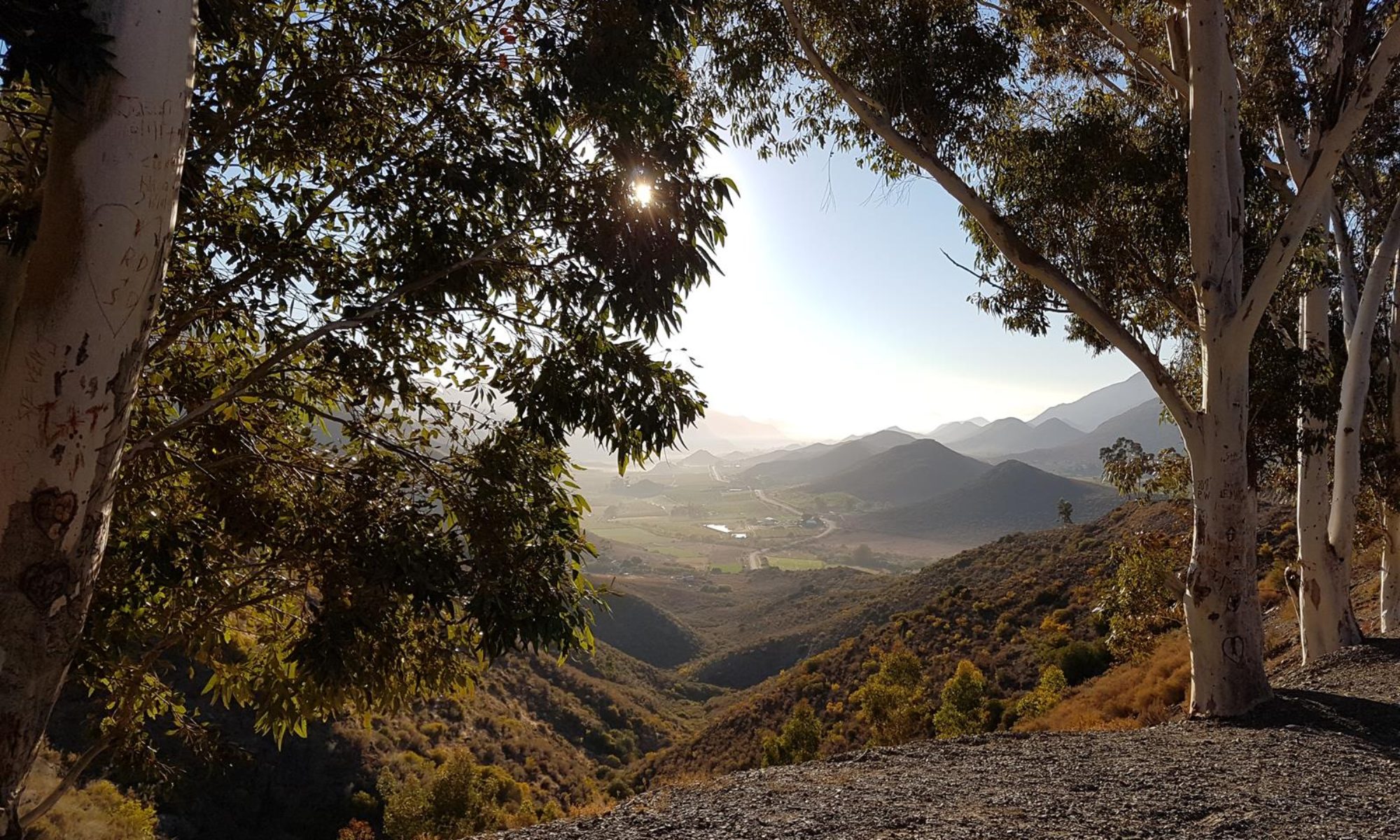
The imaginative path was clearly some part of a revitalisation project for the whole area. At the top were an assortment of colourfully painted beehives, some bearing the wording of “Bee Hotel”. There were also new benches set around small forest pools. At the far end the path dropped into a short section of pine woods that were so dense as to seem nearly pitch black through my glasses, which didn’t have time to adjust from the bright sunlight I’d been in seconds before. As I exited onto the road, a nature reserve sign pointed back the way I had come, clearly the reason for the rehabilitation work. My recollections of the trail beyond here is a little sketchy. It was predominantly still on the old railway line, much of it back along the waterside again. Soon after passing riders out on horses, and their nearby riding school, I came up behind an older chap on a very new looking blue recumbent ICE Adventure Trike (beautiful machines made close to home in Cornwall). We exchanged greetings as I passed the first time, and we caught up again a little further down the road where I stopped to snap a picture of perhaps the most quintessential Highland view I had seen so far on the whole trip.
736.5km – 19 Aug, 09:12 – Castle Stalker

By this point my self constructed room service breakfast (freeze dried granola and instant cappuccino) were beginning to wear off and I was lusting after proper coffee and real food. As well as discussing long distance riding, his magnificent trike, and where he was from (I forget if he was returning or heading to the Isle of Mull), I also enquired about whether he knew of a good food stop nearby. He mentioned a couple of places, but both sounded to be some way off route. He did helpfully suggest a better view spot for the castle further along, but it didn’t catch my imagination as much as the impression of the loch and castle rising out of the colourful border of weeds beside the path.
Just after the remains of Appin station, the trail switched over the road again a couple of times, passing a caravan park before running down to Dallachulish. My spirits lifted as I spotted a waterside restaurant tucked into a tight bend in the bay. As I pulled in and wheeled around the back though, it all looked rather too quiet for such a lovely spot on a beautiful day. Sure enough, they weren’t open. There wasn’t a lot of point standing around feeling deflated – as well as food, I need the loo, and pushing on was much more likely to find one or both of those.
The trail from here was mostly through lush woodland, although occasionally broken in at least one or two short stretches, where it was better to ride on the road than the adjacent lumpy pavement. One dogleg along a narrow tree lined lane was definitely easier to navigate with a GPS. I shared my mapping information with a couple also out on bikes, and struggling to figure the diversion we were being guided around (at that point it did seem to head the wrong way). Further along I caught up with an older couple and we rode alongside each other for a short way chatting. They were on a day ride out from one of the campsites (I think the one back at Appin). I remember being rather impressed at the pace they were clipping along at, despite neither of them being on e-bikes, and both being on the somewhat larger side. Eventually, we parted ways as my need for a comfort break overtook my desire for pleasant conversation and company.
750km – 19 Aug, 10:05 – Columba’s Diner
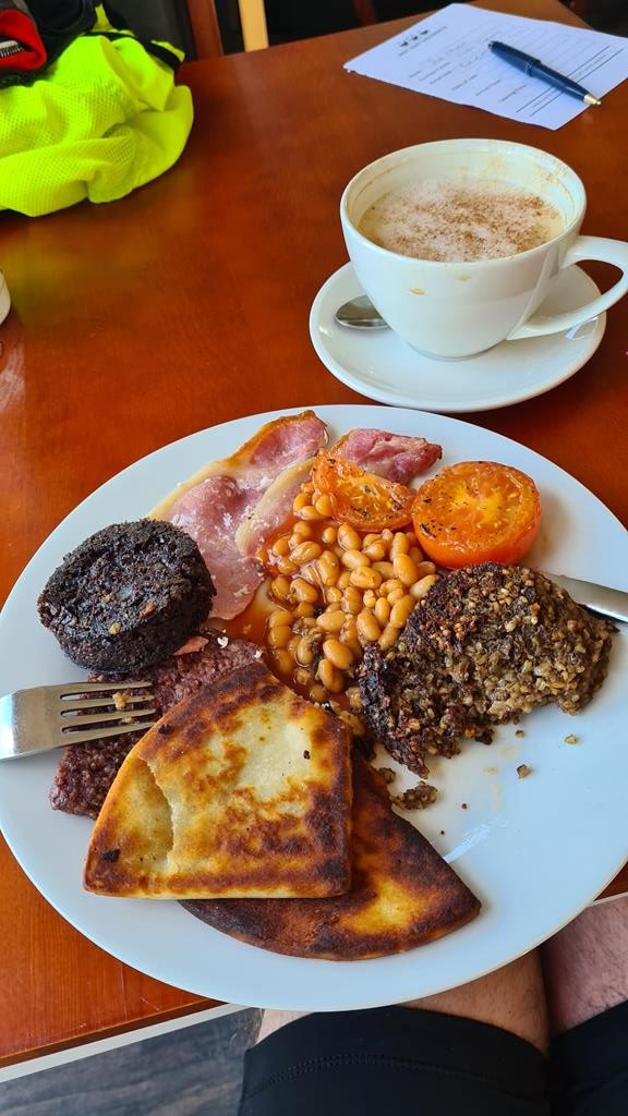
As scenic as the earlier closed established had seemed, this little oasis was the real deal. A quaint roadside café cum gift shop slash pottery, with the warmest welcome imaginable and a full cooked Scottish that was off the scale. The coffee and hospitality were so good, it was impossible not to stay for a second bowl-sized cup of cappuccino, and in fact somewhat hard to leave at all. Although a contributory factor could have been the enormous plateful of food now weighing down my belly. It was definitely a good job I wasn’t in a hurry to race anywhere. Heading out again from breakfast I passed the elderly couple again, now on the way back to their camp-site. They’d also spotted the café, and seemed a little disappointed not to have stopped when they heard of the excellent fare, although they commented that a fried breakfast would have nullified the benefit of the exercise they were taking.
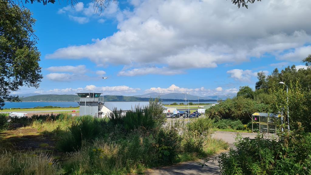
The very last section of ridiculously picturesque railway track ran out at the entrance to possibly the most picturesque regional airport in the world. I tagged pilot buddy Tyler in the photo I posted of Oban Airport, with some words along the lines that he should come fly here. Much as I’d have loved to stayed on cycle route 78, from this point it wasn’t really going my way. Waiting for a traffic light in North Connel, I was tempted to chance my luck on the side road to Bonawe rather than heading across to the main A road. I knew that at the far end of the loch there was a tantalisingly narrow crossing that at some point in the past did have a ferry. I wondered what the chances were of finding a local with a boat who would get me across the handful of metres of river mouth for a few quid. But it was a long way back if the gambit failed, so I reluctantly hopped up onto the pavement after the lights and across the bridge. The road was too narrow and busy to be pleasant, and the footpath barely wide enough for one. I free-wheeled slowly across it behind a girl walking in front of me. I guess it would just about have been possible to squeeze past, but it felt a rudely impatient move – although to be fair, she was probably just as unimpressed by this weird smelly old git on a bike stalking her across the bridge.
It was kind of sad not to be turning left onto the A85, with the delights of the Oban Whisky distillery literally just down the road. Given more time, I could probably even have plotted a cross country track from there back onto my main route, although at the expense of several hours’ detour and no doubt a fair amount of extra climbing. The A85 was tolerable rather than great – it was at least as busy with traffic as the A82 had been, but in most places was less narrow and winding which made for relatively few occasions where I was either holding up traffic, or on the receiving end of unpleasant fly-bys. The town of Taynuilt signalled both the spot where a successful ferry crossing from Bonawe would have deposited me, and also the start of a long steady uphill as the road wandered its way up the river valley. Progressively steepening hills gradually closed in on either side of the road and river, and I knew that the valley head and the first of the day’s proper climbs couldn’t be far ahead.
786km – 19 Aug, 12:49 – Loch Awe


Several things prompted me to take a short break – foremost of these was a local store, with an ice cream sign outside. But just across the road was also another idyllic view of a castle built out into the protection of the loch which, in this case, had the best name of any so far on the tour: Loch Awe. Sat there enjoying a DIY coke float (white magnum, washed down with swigs of coke), looking out on the view of Kilchurn Castle, “awe” was pretty much on the money.
I’d hoped the turn off the A85 at the head of the loch would signal quieter roads, but instead I found a confusing and fairly busy junction. There were signs (I think) indicating a routine road closure ahead on the A85. That wouldn’t have been a problem anyway – since that direction would put me back on the very worst section of A82 south from Tyndrum. But there were also signs that my route, the A83, was closed at somewhere called “Rest and be Thankful“. I wasn’t quite sure what was going on, or what to do. Martin, back at my work, narrowly beat my own google searching with the details – a recent landslip had closed the main road. Scanning the maps, there looked to be something marked as an old military road around that section, which during the day may be open as an alternate route for traffic.
The funnelling effect of closed roads led to a fair amount of traffic on the A83, in the midst of which was a slow moving rider as I ground my way over the long climb up and out of the valley. In this part of the highlands you are literally either riding along a loch, or climbing across hills to get to the next loch. As strenuous as that was, the shifting landscape from wooded valleys to open moors and mountain was also rather magical too – of course it was helped by being there on a glorious sunny summers day. The descent down to the lakeside town of Inveraray was rapid and exhilarating – most of the traffic was still faster than me, but a few of the big dump trucks only came past me at the bottom on the entrance to town. It struck me that these were probably on their way to the works ahead at the landslip. I had a mental image of pleading to be allowed past the barriers, and perhaps being granted permission (and loaned a hard hat) to scramble across mounds of earth where the road had been. Although that didn’t seem likely – earlier texts with my buddies in Glasgow (Nicola, Rod, Alastair, and Tracey) suggested I would probably be shuttled through on a roadworks pickup for safety in the convoys of traffic along the old military road.


I didn’t see much of Inveraray – my route turned left before the town itself, and headed around the loch. I just about caught a glimpse of the castle, and a lovely old stone bridge (Aray Bridge) just at the edge of town, so steep and narrow it had a traffic light to control the one way traffic. As I rolled up and down over this I could see another similar bridge far off in the distance at the top of the loch. It took a while to ride around to there and along the way, despite not being hungry, or really having time, I was tempted to make another stop. Somehow I had missed that Loch Fyne (of the salmon and fresh oysters fame) were actually from here. Passing their very smart looking restaurant, it was hard to resist turning in – mostly, of course, because of their excellent food, but also because amongst the lines of gleaming high end cars and SUVs, I’d be the most inappropriately dressed and malodorous guest in the establishment. Barely meters along the road, my resistance was pushed close to breaking point at the turn into the Loch Fyne brewery. Honestly, if anyone reading this finds themselves on the same road, do not make my mistake – plan ahead and have time to visit one or both of these.
Around the far side of the loch, at Cairndow, the road swung away from the water and began a gradual, ascent along the next valley up towards high ground once again. Except this time, I knew it was the final proper climb of the day. Somewhere up ahead was the curiously named “Rest and be Thankful”, and the landslip and old road, which my brain had been conjuring colourful pictures of negotiating for the last few hours. Although, to be honest, for the immediate present I wasn’t even really thinking about it. Between the exertion of the uphill, and the jaw dropping scenery around and ahead of me, there was more than enough to occupy me. Towards the top, it’s rugged grassy slopes had a distinctly alpine feel, quite unlike most of the passes I’d crossed so far. As I snapped a few photos, I was sucking in air hard enough that the large sign suddenly made complete sense: I was very thankful to be able to rest.
836.5km – 19 Aug, 16:42 – Rest and Be Thankful


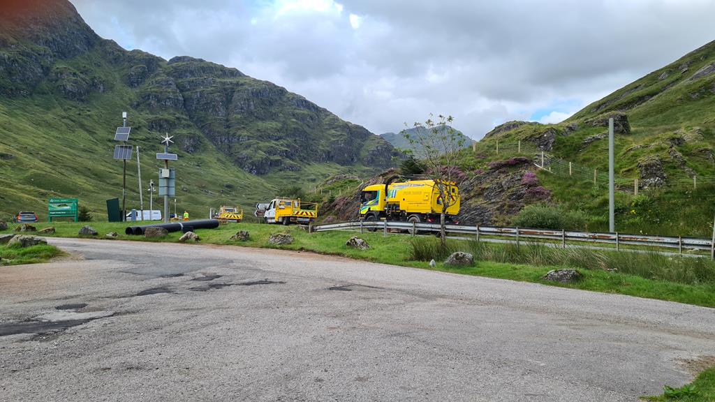


As a convoy came up from the other side of the pass, I slipped through the queue of cars to chat with the workmen at the front. Sure enough, the process was to load me up onto a works van at the tail of the next convoy going down. Although the guys didn’t resist the opportunity for a bit of leg pulling before getting to that explanation – initially pointing me at the gaping scar of earth along the closed road and commenting that my bike looked like it should be able to get across if I kept some speed up.
It took a while for the change of direction, the loading up, and the drive through. Whilst I was grateful for the safe passage, it did seem a tad unnecessary. For some reason, in my mind I had imagined the old military road went uphill, which would have made a lone cyclist a significant risk and bottleneck to the alternating flow of traffic. But as a fast downhill, I was pretty sure I could have kept up with, if not gone faster than most of the traffic on the winding descent. A point which was proved a little later as the friendly driver of the pickup suggested that I could outrun the next convoy down to the loch if I put foot. He wasn’t wrong, just one solitary fast moving BMW caught up to me and only along on the very last stretch down to the town of Ardgartan at the water’s edge.
I was clearly getting tired at this point because the obvious move of going in to Ardgartan for food only occurred to me when I was already close to the top of the loch. The town of Arrochar ahead looked too small to be promising as an option for some dinner, but it turned out to offer several options – the hotel looked decent, but the Fish and Chip shop sign a little further along spoke directly to my hunger.
847km – 19 Aug, 17:22 – Arrochar Chippy
I was about to order Tartar sauce to go with the enormous portion of scampi and proper, fat chips when I heard one of the customers behind me mention curry sauce – which immediately sounded way more tempting. Unusual fried foods are definitely a rather Scottish thing (deep fried Mars bars being the classic example), although curry sauce is a pretty ubiquitous accompaniment across most of the UK. I decided to stick with the regional feel, and opted for an Irn Bru to wash it all down (it’s made in Scotland from girders you know). I chatted with a couple of locals who were also standing outside waiting for their orders – they had the absolute cutest dog (called Lachsie) hanging out of their car window looking hopefully in the direction of the smells emanating from the shop.

Sat at the tiny roadside table, I alternated between stuffing large helpings of the tasty food into my face, scanning the map, and discussing plans with my friends who live just outside Glasgow. There was a fairly direct route from here to Alastair’s house on the A814, following the shores of Loch Long. For probably not altogether rational reasons, I was a little reluctant to take it. A wind was slowly picking up which I’d be heading into, but that wasn’t my real concern. I’d studied this area a fair bit, and had a vague recollection that although the road looked quite pleasant, it was also narrow and twisting. I was already pretty fatigued from the day – making a snap decision, late in the day, to follow a route I’d not been entirely comfortable with when planning felt like a recipe for trouble. Reluctantly I took the sensible option to stay on route over the short hill and pick up the A82 at Loch Lomond. It was cycle path from the top of the loch, although by all accounts, not one in especially good condition. It was a shame, because it also probably meant I’d only get to catch the guys for coffee as I passed through in the morning rather than a proper drink this evening. My day’s diversion had always made that fairly likely, but it was disappointing to get so close and come up short.
The final connecting link over to Tarbet was barely a hill at all – just a short ramp up to the station, followed immediately by a descent down to the junction with the A82. The road was quiet enough to make me consider simply blasting down it, but the few vehicles I saw were mostly large and fast moving. It was enough to persuade me that sticking to the bumpy, overgrown, and generally poorly maintained cycle path was the safer option. I was, at least, away from the traffic, and headed in the right direction, but it wasn’t exactly memorable (at least not for any of the right reasons) – definitely an opportunity missed, given the stunning views of the loch and surroundings.
It was a surprising distance along the banks of the loch to the accommodation Yoli had found for me near the village of Arden. The path occasionally ran beside the lake – where it passed along and through a variety of official and unofficial camp sites (wild camping is allowed in Scotland). At other points it ran beside the road, ducking in and out of various parking places – many either filled with camper vans, or bearing the hallmarks of them having been there in the form of large bags of trash piled up by overflowing bins. I’m constantly bemused by how travelling tourists can manage to bring their food and supplies with them to a beauty spot, but not manage to carry the same bottles and packaging once empty away with them afterwards. The best I could hope was that this was some known and accepted practice, and the local council would have refuse trucks swing by and cleanup these impromptu dumping sites.
The evening was getting chilly as I ploughed onwards – the freshening breeze of earlier was rising towards a full blown storm, whipping the dark angry waters of the loch into foaming white crests, a fine spray from which I could feel on the side of my face as I pedalled on. Small boats moored along the edge of the water bobbed excitedly up and down, their rigging singing out and slapping against mast and stay as the gusts tore through them. As fun as today’s unexpected adventures had been, I really wanted to be tucked up in my room before the full force of the gathering storm landed struck.
875km – 19 Aug, 20:18 – Loch Lomond Guest Houses & Lodges, Arden
As the first spots of rain started to fall, I reached the roundabout at Arden – my accommodation was only minutes away. The irony wasn’t lost on me that the other exit of the roundabout was signposted to Helensburgh – Alastair and Nicola’s home town. It’s never easy to sync up long distance cycling with plans to meet people, and today had definitely got away from me in that sense. I was shattered and smelly – and really just needed to crash in a bed.
The driveway I rode down was basically the entrance to an old stately home – in the grounds of which stood a selection of luxury wooden cabins. It was significantly more upmarket lodgings than an unkempt, road weary cyclist deserved, and almost exactly what I needed – a little touch of luxury to escape from the weather. The host (I think her name was Diane), had waited for me, and was in the middle of an indoor training session of her own when I arrived (she explained she was a tri-athlete as she led me to storage shed for the bike and then the room). As I relaxed in the pampered opulence of it all a thought occurred to me. Aggravated by the hilly terrain of the last few days, my right Achilles had flared up painfully, much as it had done on Munga. With no chance of a proper strapping by medics, my best option was some kinetic tape – but although tomorrow I was going through the centre of Glasgow and a few larger towns beyond, travelling along byways and paths was not likely to take me past many pharmacies. It seemed pretty likely though that a committed tri-athlete might have some to cope with training and event injuries. I made a mental note to ask Diane at breakfast if she could spare a couple of lengths to tide me over the next couple of day’s riding.
One final, happy thought flashed through my mind before drifting off to sleep – this was now half way, in time and distance. Niggles aside, nothing major was broken either on the bike or me.
Half an adventure still remains. Can’t wait. Ps, I learned a lot about Irn Bru today – https://foodanddrink.scotsman.com/drink/16-facts-about-irn-bru/
Haha – quality stuff